Hiking on Reunion Island
Small in size but full of contrasting landscapes, the island has more than 900 km of marked trails to offer, a real paradise for hikers!
From a dense rainforest in the east, savannah and sugar canes in the west, lunar landscapes on the volcanoes, omnipresent waterfalls, to the amazing mountains and ravines created by the eruptions in the center, everyone will find something to enjoy.
There are hiking trails for different levels, from beginners to experienced people, so no worries, you can make it!
I made a list of the most famous hiking trails on the island, but you can find more trails and detailed explanations (level, time, distance, ascending elevation, etc.) on the official website here.
Volcanoes
Piton de La Fournaise (5 hrs – 10.8 km)
Definitely the one trail on the island you do not want to miss! You can’t leave Reunion without visiting the famous volcano Piton de La Fournaise, one of the most active volcanoes of the world!
The Dolomieu crater collapsed in 2007 during an eruption while it was full of lava. Since then, the crater is 1 km long, 750 meters wide and around 350 meters deep.
It’s not authorized to go around the crater anymore, but you can admire it from a natural point of view just on the verge of the crater. During the trail you will go along several lava flows shaped over decades and enjoy a beautiful view over the ramparts and the volcano.
→ Itinerary: the trail starts at the parking lot of “Pas de Bellecombe“, where the view on the volcano is already impressive. The path is well marked so it’s easy to follow it, even during the night – just be careful in case of fog. You start the hike by going down several big steps for 15 minutes until you reach the bottom of the rampart. After that, keep walking straight to the volcano; the path is quite flat until the “Chapelle de Rosemont”. From there, you’ll need your legs to climb to the top. It’s the most tiring part, but it’s not complicated – I’m sure you can do it! Once at the top of the crater, just relax and enjoy the view from the volcano to the ocean. The way back is the same path – keep some energy to climb the steps to the parking lot, but it doesn’t take more than 20 minutes.
→ What to bring: The trail is quite rocky so you should wear good hiking shoes. Bring a jacket for the cold weather and in case of rain, pack some water and something to eat, and put some sun screen on because there are no trees. If you start the hike by night in order to be at the top for the sunrise, don’t forget to bring a sweater, pants, and a torch. A survival blanket is a plus if you have to wait some time for the sun to rise.
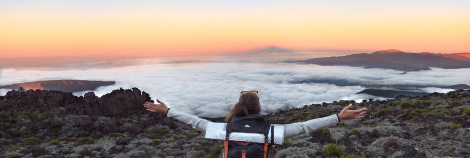
→ Tip: I recommend to start the hike during the night; time passes quickly and you won’t be too hot for the ascending part. Above all, you will be at the top for sunrise, which is an incredible experience. I would say it takes around 3 hrs to get at the top for intermediate hikers.
More information here.
Piton des Neiges from Cilaos (8 hrs – 15.5 km)
Known as the peak of the Indian Ocean, the extinct volcano rises to 3,070 meters above the sea level.
Lots of adventurous people visit this summit every day due to its accessibility and the challenge. This is a demanding hike as you climb continuously, but I’m not a pro hiker and I managed to get there without any trouble!
Once you’re up there, the 360° view is quite different from the other hikes: you will be able to see the cirque of Cilaos, but also get a view to the famous forest of Bebour with the Mazerin and the volcano Piton de la Fournaise at the East, the “Plaine des Cafres” (situated on the edge of volcanic banks), Grand Bénare just in front, the summit of the Entre Deux at the South, the Bé Massoune in the cirque of Salazie, and of course the ocean surrounding the island.
→ Itinerary: There are several ways to get to the summit but usually people start from the Bloc of Cilaos, situated at 1,380 meters in altitude. It takes around 2.5 hours of continuous ascent in the shade of the trees to get to the lodge “Caverne Dufour”, where most of the hikers spend the night before completing the climb. From the lodge, the landscape changes dramatically, it looks like a lunar landscape. It takes almost 2 extra hours for intermediate hikers to get to the top, and I would say it’s the most difficult part because the trail is dotted with big lava blocks and you have to watch your step continuously. Once at the top of the island, just enjoy the well deserved panorama for a while before going all the way down – good for your knees!
→ What to bring: It can get very cold up there (we found some ice during our hike in April), so don’t forget to bring a jacket, pants, a sweater, a cap and gloves. Some sun screen will be essential for the climb between the lodge and the summit as there are no trees to protect you. Lots of water will be necessary (I had 2 liters and refilled it at the lodge), as well as something to eat during the climb. You will also need a torch if you climb by night in order to get at the top for the sunrise. Obviously, good hiking shoes are mandatory. If it can help you, think of using hiking poles.
→ Tip: If you don’t feel like doing the whole hike at once – I think it’s very tiring because you have to start during the night and walk for a long time – there are two possibilities:
- Spend the night at the lodge before finishing the climb. You will enjoy a good “cari” for dinner and recharge your batteries.
- Camp at the summit, which is what we did. I prefer this option because the climb between the lodge and the summit is the most tiring part and people who spend the night at the lodge have to wake up early (around 4 am) to complete the climb and be at the top for the sunrise. But clearly, you will have to carry more stuff if you decide to camp: a tent, a gas cooker, some food, a sleeping bag, and a small mattress. Don’t forget the famous “rhum arrangé” to warm you up! I would say it’s an unforgettable experience to sleep at the summit of the Indian Ocean!
More info on this hike here.
Overnight in Mafate
I think the best way to discover the island and its people is a trail of at least 2 days in Mafate, the cirque accessible only on foot. This is my favorite cirque for hiking because of its inaccessibility and therefore its unspoiled nature. The inhabitants usually were born there and have learnt how to live in harmony with their surroundings. The only way to get there is on foot or helicopter, which is quite expensive, so you can imagine everybody is walking over there!
My recommendation is to spend the night in a lodge, so that you can learn the culture with the hosts and taste the local food and the typical “rhum arrangé“!
There are lots of trails in Mafate and lots of places where you can spend the night (either in a lodge or a camping), but I will describe you the three hikes I liked the most here below.
Les Orangers from Sans Souci to La Possession (8 hrs – 24 km)
This is a classic hike on the island to visit Mafate. The “canalisation des orangers” was used before in order to supply water to Saint-Paul. The islet “Les Orangers” is populated with a bit more than 20 families and is situated at 977 meters in altitude.
The route is long but flat and easy, and it offers stunning views to the cirque of Mafate all the way through, so don’t forget to bring your camera!
→ Itinerary:
Day 1 (16 km – 5hrs): The hike starts at Sans Souci with a short ascent (around half an hour). You will progressively enter the cirque of Mafate on a pleasant path, offering incredible lookouts to “Dos d’Âne” and the “Rivière des Galets”. After a few hours walking on a flat path, you will be at the intersection of the islets “Lataniers” and “Orangers”, then go up to the “Orangers” village. The view from the Orangers is very beautiful; you can see the famous summit “Maïdo” quite easily. Spend the night in a lodge there and enjoy the tranquillity of the mountains. More info on the itinerary here.
Day 2 (8 km – 3 hrs): In order to discover other landscapes and not have to use the same way back, I recommend you to follow M47 and M35 itineraries. These routes allow you to reach the river “Rivière des Galets” in the heart of the valley. From the islet “Orangers”, follow the route M47 to reach the “Lataniers” within an hour, a small village situated at 620 meters in altitude. Don’t hesitate to walk around the village to see how people live there (remember it’s accessible only on foot!) before continuing your journey. From there, follow the route M35 and keep going down all the way to the river. You will pass through some waterfalls; don’t hesitate to have a swim. Keep walking until you reach “Deux Bras“, where you can grab a 4×4 in order to go to “La Possession“. If you don’t take a 4×4, you will have to walk for 2.5 hrs extra, so I highly recommend you to take it (last time I went there the road was under construction so we had to walk and it was wayyyy too long!). Don’t forget to call them in advance in order to book the ride.
→ What to bring: good hiking shoes, water, crackers, a lunch for day 1, a cap, sun screen, a sweater and leggings for the night (it gets cold as soon as the sun goes down), a jacket in case of rain, your pyjamas, tooth brush, socks, towel, and all that! Don’t forget to bring a swimsuit if you want to have a swim in the river. An external battery can be a plus because not every lodge has plugs available.
→ Tip: I recommend you to use Trip Advisor in order to find a lodge in Mafate. I think the most important part of the visit is to exchange with the host, which is not always the case (sometimes they just serve you the food and that’s it), so have a look at the comments before booking a lodge. Also, for the way back, and this is very important, be aware of the conditions around the “Rivière des Galets”: it can be dangerous to cross the river during the rainy season, and don’t forget to call the 4×4 in order to know whether they are working or not (don’t do the same mistake as us haha!). Last but not least, I guess you noticed that following this itinerary, you won’t be back at the same place where you started: you should leave a car at La Possession on the parking and go to Sans Souci with another car in order to start the hike. Or you can also hitchhike if you only have one car!
If you are looking for more information on the possible itineraries, have a look here.
Aurère from Sentier Scout & Sentier Augustave (6.5 hrs – 15.8 km)
Aurère is the most northern islet of Mafate, situated at the foot of “Piton Cabri” at 930 meters in altitude. Its population is around 90 inhabitants.
This hike also offers beautiful views, but it’s more tiring than the “Canalisation des Orangers” because of the elevation on the way back: you will have to go down on the first day and then go all the way up on the second day to make it to the parking lot.
→ Itinerary: You can decide either to start from Scout and go back through Augustave or the opposite, but I recommend not to follow Sentier Augustave for going down during the rainy season because it’s slippery.
Day 1: The start of the hike is situated on a parking lot near “Col des Boeufs“, in the beautiful cirque of Salazie. Follow “Sentier Scout“, which will lead you directly to Aurère. You will get a stunning view over Mafate quickly, above all over “Piton Cabri” that dominates Aurère. The downhill to “Ilet à Malheur” is quite long but pretty, and you will be in the shade of the trees for the last part. From “Ilet à Malheur”, it takes less than an hour to reach Aurère; this is the only part of the route for which you have to go up. Once at Aurère, enjoy a good beer for the sunrise before having a hot shower at your lodge!
Day 2: After a good breakfast, be prepared to go all the way up! But first, enjoy the beautiful view from “Bord Bazar“, just at the edge of the village. Now, follow “Sentier Augustave“, a very beautiful path combining ladders, small rivers to cross and waterfalls. I remember the climbing was a bit tiring but worth it!
More info here.
→ What to bring: good hiking shoes, water, crackers, a lunch for day 1, a cap, sun screen, a sweater and leggings for the night (it gets cold as soon as the sun goes down), a jacket in case of rain, your pyjamas, tooth brush, socks, towel and all that! An external battery can be a plus because not every lodge has plugs available.
→ Tip: Don’t start the hike too late if you’re planning to follow Sentier Augustave and if it’s rainy, the water level might rise quickly.
La Nouvelle from Col des Boeufs (5 hrs – 14.8 km)
If you don’t feel like walking too much, this is a short and easy hike that leads you to “La Nouvelle“, the most populated village of Mafate with a population of 150 inhabitants, at 1,400 meters in altitude. Actually this hike is the quickest way to enter Mafate.
You will be in the heart of Mafate, having amazing views over the summits “Gros Morne” (second highest peak), “Grand Bénare” (third highest peak), and the “Maïdo”.
→ Itinerary: The hike starts from the big parking lot of “Col des Boeufs“, in the cirque of Salazie. You will have to walk for less than 30 minutes along the beautiful cryptomerias forest in order to get to “Col des Boeufs” and appreciate the cirque of Mafate. From there, follow “La Nouvelle”, you will go all the way down, passing through the “Plaine des Tamarins” (a tamarind plain). We took less than 2 hours to reach La Nouvelle, so take your time – there’s no rush. Once at “La Nouvelle”, don’t hesitate to walk around the village before having a fresh beer at one of the bars. The way back on the following day is the same, although you could choose to make a loop through “Marla”, another islet near La Nouvelle.
For more info, click here.
→ What to bring: Hiking shoes, water, crackers, a cap, sun screen, a sweater and leggings for the night (it gets cold as soon as the sun goes down), a jacket in case of rain, your pyjamas, tooth brush, socks, towel and all that! An external battery can be a plus because not every lodge has plugs available.
Most famous trails
Grand Bénare (5-6 hrs – 18 km)
One of my favorite trails for the amazing view over Mafate during the whole hike!
Grand Bénare is the third highest peak of the island, situated at 2,896 meters in altitude. It offers a spectacular view to the cirques of Mafate and Cilaos, probably the best of the island.
→ Itinerary: The hike starts at the “Maïdo“, situated at 2,200 meters in altitude and offering a view to the cirque of Mafate. From the parking lot, follow the concrete path and turn left after a few hundred meters to follow the path “Grand Bord“. The trail goes up regularly along the rampart all the way to Grand Bénare. Be careful and don’t walk away from the path, there are several deep faults caused by the last eruptions. The path is quite rocky; that’s the main reason of exhaustion and not the difference in height. Once at the top of Grand Bénare – marked by a white cross – you will be situated between Mafate and Cilaos, separated by a crest going from the Gros Morne (second highest peak) to Grand Bénare passing through the 3 Salazes (3 rocky peaks) and the Taïbit pass. For the way back to the Maïdo, you can either follow the same path, or follow “La Glacière”, which is a bit longer (around 2 km extra) and it doesn’t go along the rampart but it’s easier.
→ What to bring: There are no trees on the path, so don’t forget to wear a cap and put some sun screen on. Hiking shoes, lots of water, some crackers, a sweater because it’s cold at the summit. Don’t forget to bring a jacket in case of rain.
→ Tip: Be at the Maïdo for the sunrise, it’s amazing to see the set of lights in the mountains! I recommend you to start the hike at 7 am in order to be at Grand Bénare at 10 am. After that it can get very cloudy and it would be a shame to go all the way for no view.
More info here.
Trois Salazes (10-12 hrs – 8.2 km)
Be prepared for vertigo and one of the best views on the island!!
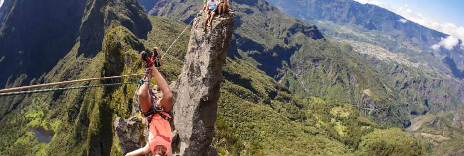
I don’t really consider this itinerary as a hike because it’s more an amazing adventure than a peaceful walk: climbing, zip line and rappelling are a must.
It’s a short but complicated hike that joins the “Ilet à Cordes” road to the crest of the Salazes, those famous 3 easily distinguishable rocky peaks, situated between the cirques of Mafate and Cilaos. The edge is quite craggy and dangerous (around 300 meters height from each side), with several very narrow passages.
So you will probably say “there’s no way I’m doing this!”, but it’s actually accessible to almost everyone (no kids allowed), on the condition that you don’t suffer from vertigo. There’s no need to be a good climber but you will definitely need a guide to secure you all the way along the edge. I did this awesome experience with Thierry, who I highly recommend; he is very friendly and puts safety first. At the time we did it (March 2018) we paid 80€ per person.
→ Itinerary: the hike starts at the parking of the “Col du Taïbit” near the village of Cilaos, at around 4 am. Be wide awake because you will start the hike by going up continuously for 2.25 hrs to get to the crest, it’s a bit tiring but I think time passes more quickly by night. Once you are at the top, you will enjoy the amazing view over the cirques of Mafate and Cilaos at sunrise. From there, it takes around 3 hrs to get to the foot of the Salazes, everyone equipped with a safety helmet and roped up to each other. This is the most difficult part, which involves some climbing and rappelling, but it’s very fun! Once at the foot of the 3 rocky peaks, we can climb the central peak, and from there enjoy a zip line leading to the first peak (this is not mandatory if you don’t want to do it, but I recommend it!). Then, you go all the way back to the parking lot.
→ What to bring: a torch, hiking shoes or sneakers, a jacket in case of rain, a sweater, water for the whole day, some crackers and a lunch, sun screen.
→ Tip: Enjoy, enjoy, enjoy!
If you want to have an idea of what it looks like, here is the video I made of this incredible day:
For experienced hikers
The island offers 3 long-distance hiking trails for experienced hikers:
- the GR R1 (60 km) around Piton des Neiges and the 3 cirques,
- the GR R2 (130 km) that crosses the island from North to South passing trough Piton des Neiges and Piton de la Fournaise,
- and the R3 (38 km) that crosses the cirque of Mafate.
I haven’t tested those trails, but you can find more information on those on Rando Pitons website.
Beaches on Reunion Island
Reunion Island offers some 30 km of black and white sand beaches, of which 22 km are well-preserved lagoons.
The sun invites you to relax on the beach and enjoy different activities: swimming, snorkeling, kayaking, paddle boarding, etc… The clear waters of the lagoons provide great visibility for discovering multi-colored fish.
Swimming in the ocean is authorized in several areas, which are either supervised by lifeguards or protected by the coral reef. Aquatic activities (surf, bodyboard, bodysurf, longboard, paddle board) outside those areas are prohibited because of the potential presence of sharks. But don’t worry for that as long as you swim in an authorized spot – there’s no risk! Actually I have never seen a shark here.
Bathing areas
The authorized bathing areas are situated on the Western and the Southern coasts, from Saint-Gilles to Saint-Philippe.
My favorite spots are l’Ermitage for its lagoon and Grande Anse for its nature. Here is an exhaustive list of all the beaches where you can swim – from West to South:
- Boucan Canot: beautiful beach between Saint-Paul Saint-Gilles with a natural swimming pool formed by volcanic rocks. I like this beach for its many bars, restaurants and shops, but the bathing area is quite small. I would recommend to go there to enjoy a lunch and do some shopping.
- L’Ermitage: the most beautiful beach for its turquoise water, near Saint-Gilles. It’s a family beach where you can enjoy swimming in shallow water. The lagoon is ideal for snorkeling; please respect the corals. I also love this site for its bars and restaurants (au K’banon, la Bobine), where you can enjoy a good cocktail with a view of the ocean.
- La Saline: this beach is similar and close to l’Ermitage – beautiful lagoon for snorkeling and shallow turquoise water. If I had to recommend a bar/restaurant, that would be “L’Uni Vert” without any doubt!
- Saint-Leu: Saint-Leu is a small city between Saint-Gilles and Saint-Pierre. Its lagoon is also protected by the coral reef, but the water is not as turquoise as in the West.
- Etang-Salé: large volcanic sand beach with palm trees and lots of waves! A basin was created so that people can swim without any risk, and lifeguards supervise the beach. I like to go to this beach at the end of the day when the dark sand doesn’t burn the feet anymore. It’s a perfect place for beach games like beach volley, beach tennis, slack line, etc.
- Saint-Pierre: Saint-Pierre is the third largest city of the island. The beach is situated very close to the city center and surrounded by the coral reef.
- Grande Anse: the most natural beach and therefore the most beautiful to me. Grande Anse is situated in the South, near “Petite-Île”. It’s a white sand beach covered by palm trees. A basin was created like in Etang-Salé because there is no lagoon. I love enjoying the day there (snorkeling is also possible) and then have a good cocktail with a view at the Palm Hotel. I recommend making a stop at the small hill near the beach in order to have a walk and enjoy the beautiful view over the ocean.
- Manapany-les-Bains: Manapany is situated near Grande Anse. A basin was also created, but I would say it’s way better in Grande Anse!
Top 5 activities on Reunion island
Here are my top 5 activities on the island, tested and approved by myself!
DOLPHIN & WHALE WATCHING
Meeting a marine mammal in its natural environment is always an unforgettable experience. The stunning waters of Reunion Island contain a lot of multicolored fishes and corals, but there are more impressive visitors: dolphins and whales.
All year long, you can observe dolphins swimming near the coast of the island. There are two species living there: pantropical spotted dolphins and bottlenose dolphins.
During winter (above all from July to September), Reunion Island is one of the best places in the world to observe whales, mostly the impressive humpback whales. Along with these, you can also spot sperm whales and fin whales.
There are two ways to meet those mammals:
- Meet them by boat: I recommend the tour with the company “Lady La Fée“. They organize catamaran cruises in the morning and in the afternoon. It’s better to go on an excursion in the morning when the ocean is more quiet, plus you get the breakfast! I’ve done it 3 times so far and it’s always a breathtaking show.
- Swim with them: in order to swim with them, you should book a trip with a diving club and you might be lucky enough to swim alongside one of those impressive animals, but don’t be scared – they are totally harmless! You can find several diving clubs on the island, but this one might be the cheapest one; ask for David: Plongée Péï.
HIKING
Small in size but full of contrasting landscapes, the island has more than 900 km of marked trails to offer, a real paradise for hikers!
From a dense rainforest in the east, savannah and sugar canes in the west, lunar landscapes on the volcanoes, ubiquitous waterfalls, to the amazing mountains and ravines created by the eruptions in the center, everyone will find something to enjoy.
There are hiking trails for different levels, from beginners to experienced people, so no worries, you can make it!
See more on hiking trails in this section.
CANYONING
Reunion island has plenty of exceptional canyoning sites. There are actually more than 100 diverse sites, dizzying waterfalls, zip lines, slides, etc.
The canyoning sites of Trou Blanc in Salazie, Fleur Jaune and Bras Rouge in Cilaos have largely contributed to make Reunion island an internationally renowned place. But there are so many more…
I have myself tested the canyoning of Trou Blanc, which was awesome! It’s known to be the most fun on the island, as it combines zip lines, slides, waterfalls, rappelling and jumps.
Next on my list is the canyoning of Takamaka, known to be very technical, but also one of the most beautiful. It takes the whole day and there are many water movements. Usually, guides won’t bring you there unless you’ve already done other canyoning sites with them.
If you’re interested in canyoning, I recommend you to get in touch with Thierry. He is very professional, friendly, and he puts safety first.
FROM THE SKY
If you’re running out of time to visit the island or if you don’t really like to hike, or – if like me – you want to discover the island from another point of view, I highly recommend you to try one of these activities in the air.
Between summits and lagoons, you can enjoy the spectacular landscapes by paragliding, skydiving, ULM or helicopter.
I went paragliding last October with my family and we won’t forget it. We flew during 45 minutes, enjoyed the view over the mountains, ravines and the lagoon of Saint-Leu. We got so lucky – we saw a whale and its baby! I can recommend the agency Adrenaline based in Saint-Leu, which organizes flights from 20 minutes to 1 hour.
I also had the opportunity to do the ULM tour with Planetair974 (from the airport of Pierrefonds) – it was magic! I did the 1-hour tour and flew over the whole island, from the coastline to the cirques passing through the volcanoes and so many waterfalls. I felt suddenly so small and it’s just amazing to see new places accessible only by air.
I haven’t tested the skydiving nor the helicopter yet; I know the helicopter tours are similar to the ULM, it’s just that it’s more expensive and you can access the waterfalls closer because the helicopter is more stable and can go deeper in the ravines. About skydiving, my sister is going to do it (with Para-club Bourbon) so I’ll tell you more about it, but I guess it’s big sensations!
SCUBA DIVING
Reunion island has a wide variety of sea beds, wrecks, and an interesting marine topography due to the recent volcanic activities. A marine natural reserve was created in 2007 in order to protect the coral reef.
I would say the coral reef is not the most beautiful I’ve ever seen because the island is considered young (yeah, only 3 million years) and the coral hasn’t had the time to develop a lot yet. Still, it’s interesting to dive there because you will find a rich and varied marine wildlife, and of course some corals!
Turtles are often observed in the West coast, inside the lagoon. You can actually meet one of them simply snorkeling; most of the time we spot them in La Saline-les-Bains. Turtles are also often observed in Cap La Houssaye, but you can only dive there.
There are several diving clubs on the island, for all types of level. Initiations and diving lessons are usually done in easy sites like Cap La Houssaye (no need to take the boat) and Saint-Leu. The most experienced divers will find multiple sites: wrecks off Boucan Canot, Saint-Gilles or Saint-Leu, the fishway of the Ermitage (Saint-Gilles), or La Pointe au Sel (Saint-Leu) with a descent of 70 meters approached by tuna, jackfish, dolphins, etc. I’ve heard that the seabed of Sainte-Rose (east coast) is impressive and you can explore the lava flows.
I am myself currently passing my diving license (FFESSM), and it’s always very exciting!
Reunion Island
Reunion Island is a small French island of 2,511 km2 (970 sqm) situated in the Indian Ocean, east of Madagascar. I spent more than 4 months there and I can tell you the island has everything a traveller could ask for! From its beaches to the mountains heading through one of the most active volcano in the world, …

